
Map Latitude and Longitude Values are not supporting
15 September, 2015
Hi,
We are using GIS maps and here we are mentioning India�s map Boundaries (Lat & Long Value) even though if we mentioned this Values in our output we are getting Bigger Map outside the Given Lat and Long Values. We are not getting the Map as per the given Lat and Long values,
The other issue is we are not able to specify
�North� and �South� for Latitude
�East� and �West� Values for Longitude
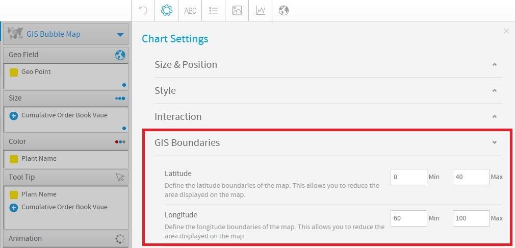
GIS boundary Settings in YF:

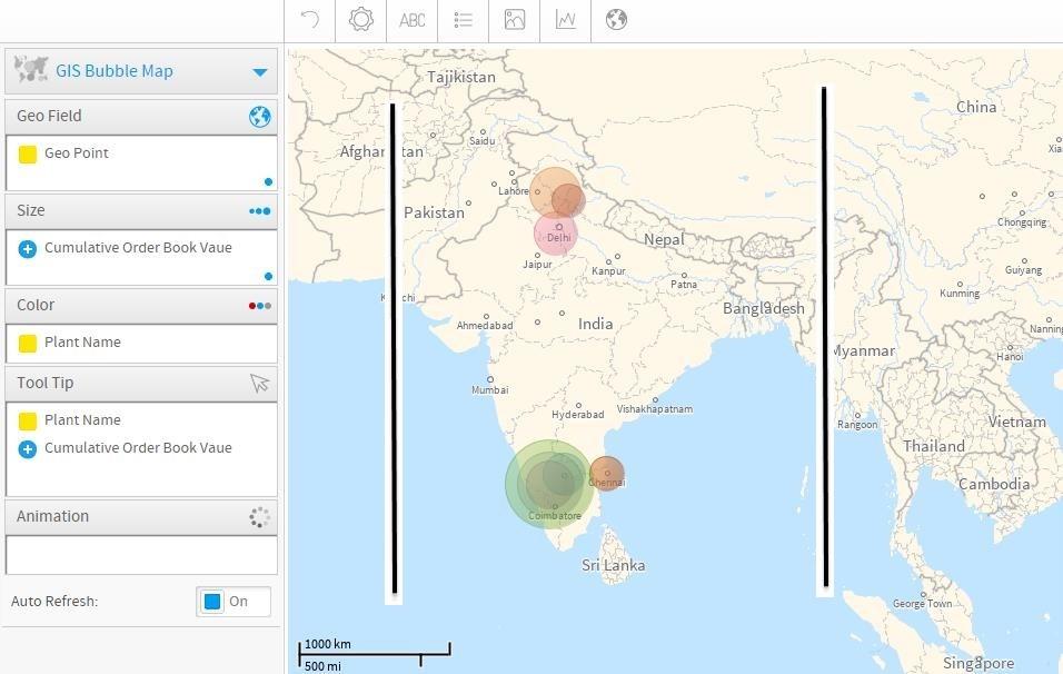
OUTPUT:
Kindly let us know if we are missing any settings.
Regards,
Prateek
We are using GIS maps and here we are mentioning India�s map Boundaries (Lat & Long Value) even though if we mentioned this Values in our output we are getting Bigger Map outside the Given Lat and Long Values. We are not getting the Map as per the given Lat and Long values,
The other issue is we are not able to specify
�North� and �South� for Latitude
�East� and �West� Values for Longitude
GIS boundary Settings in YF:
OUTPUT:
Kindly let us know if we are missing any settings.
Regards,
Prateek
Hi Prakeet,
Thanks for the question.
1. Seeing more of the map than specified.
You are seeing more of the map than you specify in settings due to the aspect ratio of the map window. You can adjust the size of the map window using the adjuster available in the bottom right hand corner. The software must then fit your specified constraints in the map window in the largest size possible, without changing the aspect ratio of the map image. If you want to ONLY see your constrained values, you will need to ensure that the map window is of the same aspect ratio. For example, if your constraining values form a square, then the map window will also need to be dragged into a square. If your values form a rectangle, the map window will need to be a rectangle of similar proportions.
2. East/west, North/south.
This is controlled by positive or negative values.
For example if you want to indicate West 60, you would use -60. If you wanted to specify south 40 you would use -40.
Keep me posted and let me know if you have any questions or concerns.
Kind regards,
Cadell.